Beloha
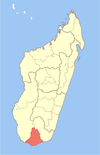
Place in Androy, Madagascar
Beloha Beloha-sur-Androy | |
|---|---|
| 25°10′26″S 45°03′36″E / 25.17389°S 45.06000°E / -25.17389; 45.06000 | |
| Country |  Madagascar Madagascar |
| Region | Androy |
| District | Beloha |
| Elevation | 154 m (505 ft) |
| Time zone | UTC3 (EAT) |
| Postal code | 609 |
Beloha is a rural municipality in Androy Region, Madagascar. It is situated along the unpaved Route nationale 10.
Beloha is situated near the Cape Sainte Marie, the southernmost point of Madagascar. At Cape Sainte Marie is also a wildlife reserve. This is the semi-arid region of Madagascar. A water-pipeline of 225 km is presently under construction if the tubes will not be embezzled.[2]
The population uses to eat crickets to survive.[3][4][5]
References
- ^ Estimated based on DEM data from Shuttle Radar Topography Mission
- ^ www.presidence.gov.mg
- ^ Crickets to the rescue
- ^ Shield-backed katydids in Madagascar with the description of a new genus and three new species (Orthoptera: Ensifera: Tettigoniidae: Tettigoniinae: Arytropteridini)
- ^ Cricket Powder Provides Valuable Nutrients for Vulnerable Populations
25°10′26″S 45°3′36″E / 25.17389°S 45.06000°E / -25.17389; 45.06000
- v
- t
- e
Communes in the Androy Region of the Republic of MadagascarCapital: Ambovombe-Androy
- Ambanisarike
- Ambazoa
- Ambinany
- Ambohimalaza
- Ambonaivo
- Ambondro
- Ambovombe
- Ampamata
- Andalatanosy
- Andraivo
- Anjeky Ankilikira
- Antanimora Sud
- Befeno
- Erada
- Imanombo
- Jafaro
- Maroalomainty
- Maroalopoty
- Marovato Befeno
- Sihanamaro
- Ambahita
- Ambatomainty, Androy
- Ambatosola
- Anivorano Mitsinjo
- Anja Nord
- Ankaranabo Nord
- Antsakoamaro
- Bekitro
- Bekily Centre
- Belindo Mahasoa
- Beraketa
- Besakoa
- Beteza
- Bevitiky
- Manakompy
- Maroviro
- Morafeno Bekily
- Tanambao Tsirandrana
- Tanandava
- Tsikolaky
- Vohimanga
- Anjapaly
- Antaritarika
- Faux Cap
- Imongy
- Nikoly
- Marovato
- Tsiombe
- Ampamata
- Ambinany
- Andraivo
- Antanimora Sud
- Andalatanosy
- Befeno
- Imanombo
- Jafaro
- Sihanamaro.[1]
4 districts; 56 communes
 | This Androy location article is a stub. You can help Wikipedia by expanding it. |
- v
- t
- e
- ^ antanimora-sud-demande un district


