Nghi Sơn
You can help expand this article with text translated from the corresponding article in Vietnamese. (April 2020) Click [show] for important translation instructions.
- View a machine-translated version of the Vietnamese article.
- Machine translation, like DeepL or Google Translate, is a useful starting point for translations, but translators must revise errors as necessary and confirm that the translation is accurate, rather than simply copy-pasting machine-translated text into the English Wikipedia.
- Do not translate text that appears unreliable or low-quality. If possible, verify the text with references provided in the foreign-language article.
- You must provide copyright attribution in the edit summary accompanying your translation by providing an interlanguage link to the source of your translation. A model attribution edit summary is
Content in this edit is translated from the existing Vietnamese Wikipedia article at [[:vi:Nghi Sơn]]; see its history for attribution. - You may also add the template
{{Translated|vi|Nghi Sơn}}to the talk page. - For more guidance, see Wikipedia:Translation.
Town in North Central Coast, Vietnam
Nghi Sơn Thị xã Nghi Sơn | |
|---|---|
Town (Class-4) | |
| Nghi Sơn town | |
 | |
 | |
| Country |  Vietnam Vietnam |
| Region | North Central Coast |
| Province | Thanh Hóa |
| Seat | Hải Hòa |
| Area | |
| • Town (Class-4) | 175.91 sq mi (455.61 km2) |
| • Urban | 70.76 sq mi (183.28 km2) |
| Population (2019) | |
| • Town (Class-4) | 307,304 |
| • Density | 1,700/sq mi (670/km2) |
| • Urban | 195,052 |
| • Urban density | 2,800/sq mi (1,100/km2) |
| Time zone | UTC+7 (UTC + 7) |
Nghi Sơn is a district-level town (thị xã) of Thanh Hóa province in the North Central Coast region of Vietnam.
Nghi Sơn was formerly Tĩnh Gia District, a rural district of Thanh Hóa Province, with its district capital lying at Tĩnh Gia township. On April 22, 2020, Tĩnh Gia District was dissolved to form the new district-level town of Nghi Sơn.
As of 2019 the town had a population of 307,304.[1] The town covers an area of 455.61 km². The town seat lies at Hải Hòa (former Tĩnh Gia township).[1]
Nghi Sơn Town is subdivided to 31 commune-level subdivisions, including 16 wards (phường) of: Bình Minh, Hải An, Hải Bình, Hải Châu, Hải Hòa, Hải Lĩnh, Hải Ninh, Hải Thanh, Hải Thượng, Mai Lâm, Nguyên Bình, Ninh Hải, Tân Dân, Tĩnh Hải, Trúc Lâm, Xuân Lâm and 15 rural communes (xã) of: Anh Sơn, Các Sơn, Định Hải, Hải Hà, Hải Nhân, Hải Yến, Nghi Sơn, Ngọc Lĩnh, Phú Lâm, Phú Sơn, Tân Trường, Thanh Sơn, Thanh Thủy, Trường Lâm, Tùng Lâm.
Climate
| Climate data for Tĩnh Gia, Nghi Sơn District | |||||||||||||
|---|---|---|---|---|---|---|---|---|---|---|---|---|---|
| Month | Jan | Feb | Mar | Apr | May | Jun | Jul | Aug | Sep | Oct | Nov | Dec | Year |
| Record high °C (°F) | 33.5 (92.3) | 36.4 (97.5) | 38.2 (100.8) | 39.8 (103.6) | 44.1 (111.4) | 42.0 (107.6) | 42.2 (108.0) | 40.1 (104.2) | 38.3 (100.9) | 34.6 (94.3) | 35.5 (95.9) | 30.8 (87.4) | 44.1 (111.4) |
| Mean daily maximum °C (°F) | 20.1 (68.2) | 20.5 (68.9) | 22.7 (72.9) | 27.0 (80.6) | 31.4 (88.5) | 33.6 (92.5) | 33.6 (92.5) | 32.3 (90.1) | 30.6 (87.1) | 28.3 (82.9) | 25.3 (77.5) | 21.9 (71.4) | 27.3 (81.1) |
| Daily mean °C (°F) | 17.1 (62.8) | 17.8 (64.0) | 20.0 (68.0) | 23.7 (74.7) | 27.5 (81.5) | 29.4 (84.9) | 29.5 (85.1) | 28.5 (83.3) | 27.1 (80.8) | 24.8 (76.6) | 21.8 (71.2) | 18.5 (65.3) | 23.8 (74.8) |
| Mean daily minimum °C (°F) | 15.1 (59.2) | 16.0 (60.8) | 18.2 (64.8) | 21.6 (70.9) | 24.6 (76.3) | 26.4 (79.5) | 26.5 (79.7) | 25.7 (78.3) | 24.5 (76.1) | 22.4 (72.3) | 19.3 (66.7) | 16.1 (61.0) | 21.4 (70.5) |
| Record low °C (°F) | 3.0 (37.4) | 6.8 (44.2) | 7.8 (46.0) | 12.7 (54.9) | 16.6 (61.9) | 19.5 (67.1) | 21.6 (70.9) | 21.3 (70.3) | 17.1 (62.8) | 15.0 (59.0) | 9.7 (49.5) | 4.3 (39.7) | 3.0 (37.4) |
| Average precipitation mm (inches) | 38.7 (1.52) | 36.3 (1.43) | 49.1 (1.93) | 59.1 (2.33) | 134.8 (5.31) | 139.4 (5.49) | 172.7 (6.80) | 268.5 (10.57) | 449.4 (17.69) | 352.9 (13.89) | 96.4 (3.80) | 33.6 (1.32) | 1,841.4 (72.50) |
| Average rainy days | 10.7 | 12.3 | 14.6 | 11.3 | 10.6 | 9.3 | 10.4 | 14.6 | 14.7 | 13.3 | 8.8 | 6.7 | 138.3 |
| Average relative humidity (%) | 87.1 | 89.3 | 90.6 | 89.3 | 84.0 | 79.2 | 79.4 | 83.8 | 86.0 | 84.7 | 82.9 | 82.8 | 84.9 |
| Mean monthly sunshine hours | 72.8 | 54.2 | 61.1 | 119.4 | 204.7 | 199.7 | 212.9 | 181.2 | 163.4 | 160.3 | 122.8 | 102.9 | 1,649.9 |
| Source: Vietnam Institute for Building Science and Technology[2] | |||||||||||||
References
- ^ a b "Districts of Vietnam". Statoids. Retrieved March 19, 2009.
- ^ "Vietnam Institute for Building Science and Technology" (PDF). Retrieved 16 August 2023.
19°25′01″N 105°45′00″E / 19.417°N 105.750°E / 19.417; 105.750
- v
- t
- e
Cities in Vietnam
| Special |
|
|---|---|
| Class-1 |
|
| Class-1 |
|---|
| Class-1 | |
|---|---|
| Class-2 | |
| Class-3 |
|
| ||
|---|---|---|
| Thanh Hóa province | 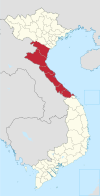 | |
| Nghệ An province | ||
| Hà Tĩnh province | ||
| Quảng Bình province |
| |
| Quảng Trị province | ||
| Thừa Thiên Huế province |
| |
※ denotes provincial seat. | ||
Authority control databases | |
|---|---|
| International |
|
| National |
|
 | This article about a location in Thanh Hóa Province, Vietnam is a stub. You can help Wikipedia by expanding it. |
- v
- t
- e


