Trí Phải
Commune and village in Cà Mau, Vietnam
9°24′21.5″N 105°09′02.4″E / 9.405972°N 105.150667°E / 9.405972; 105.150667 Vietnam
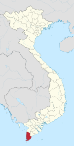
 (2009)
Trí Phải is a commune (xã) and village in Thới Bình District, Cà Mau Province, in southern Vietnam. The village centre is approximately 34 kilometres (21 mi) by road north of Ca Mau, and lies at the crossroads of the National Route 63 and Route 981 and two canals, connected to the Trẹm River.[1]
History
In 1987 it was reported that the communes of Trí Phải Tây and Trí Phải Trung merged. At the time the commune of Trí Phải Tây had a population of 4,140 people and covered an area of 4,339 hectares.[2]
As of 2009 the area was 38.7 km2 and the population was 11,894, with a density of 307.4/km2. The age breakdown was[3]
- 0–14 years: 2,930
- 15–64 years: 8,290
- 65+ years: 680
Administrative divisions
The commune is divided administratively into the following subcommunes:[4]
- Trí Phải Tây
- Trí Phải Trung
- Trí Phải Đông
- Trí Phải
Landmarks
Trí Phải contains the adjacent churches Nhà thờ Huyện Sử and Nhà Thờ Trí Phải.[1]
References
- ^ a b Trí Phải, Google Maps, Retrieved 4 June 2020.
- ^ "CỘNG HOÀ XÃ HỘI CHỦ NGHĨA VIỆT NAM" (in Vietnamese). thuvienphapluat.vn. Retrieved 4 June 2020.
- ^ "Trí Phải : Rural Commune in Cà Mau Province", citypopulation.de, retrieved 2020-06-04
- ^ "HỘI ĐỒNG CHÍNH PHỦ" (in Vietnamese). thuvienphapluat.vn. Retrieved 4 June 2020.
- v
- t
- e
- Wards:
- 1
- 2
- 4
- 5
- 6
- 7
- 8
- 9
- Tân Thành
- Tân Xuyên
- Communes:
- An Xuyên
- Định Bình
- Hòa Tân
- Hòa Thành
- Lý Văn Lâm
- Tắc Vân
- Tân Thành
- Cái Đôi Vàm
- Phú Mỹ
- Phú Tân
- Phú Thuận
- Rạch Chèo
- Tân Hải
- Việt Thắng
- Tân Hưng Tây
- Nguyễn Việt Khái
- Thới Bình
- Biển Bạch
- Biển Bạch Đông
- Hồ Thị Kỷ
- Tân Bằng
- Tân Lộc
- Tân Lộc Bắc
- Tân Lộc Đông
- Tân Phú
- Thới Bình
- Trí Lực
- Trí Phải
- U Minh
- Nguyễn Phích
- Khánh Hội
- Khánh Hòa
- Khánh Tiến
- Khánh Thuận
- Khánh Lâm
- Khánh An
 | This article about a location in Cà Mau province, Vietnam is a stub. You can help Wikipedia by expanding it. |
- v
- t
- e


